C&C Marine

cc-marine presents NavStation

NavStation: a single software, a single interface

Discover NavStation: a single application with all the main onboard services and a SOLAS Compliant Passage Plan.

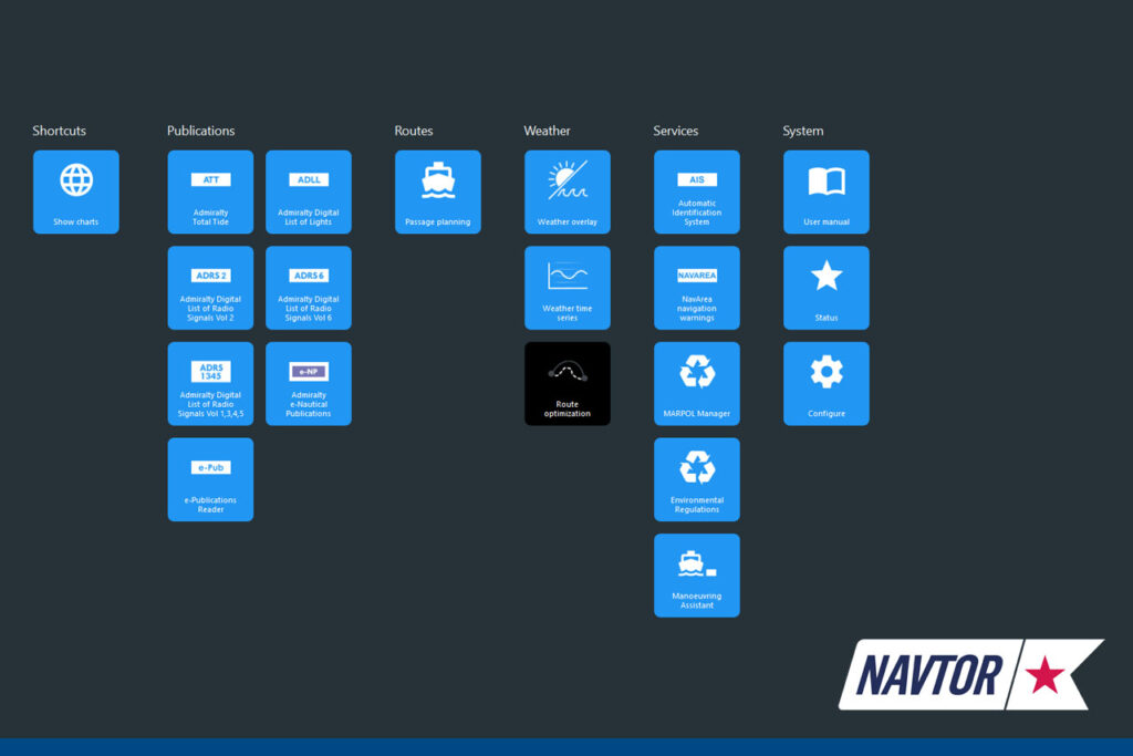
With Navtor AS’s NavStation, installed on a the bridge’s computer, you can integrate all the main services useful for drafting a SOLAS Compliant “Passage Plan” into a single application.

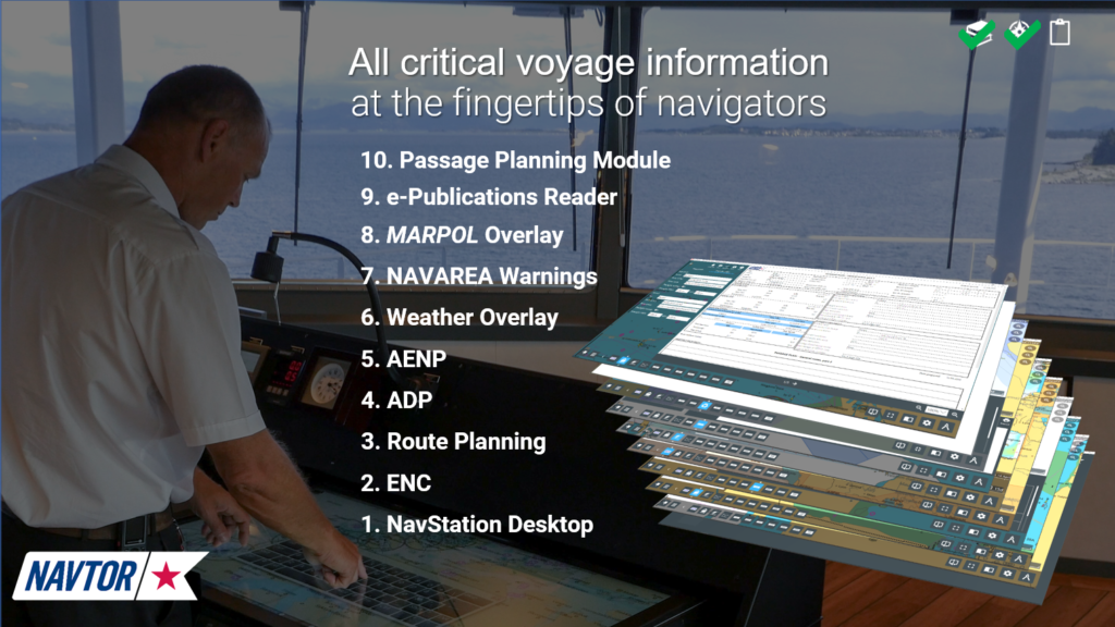
The system draws on the following integrated services: official ENC maps, Route Planning, Admiralty Digital Publications, Navarea Warnings, Navtex layer, AIO, Weather forecast, Enviromental Manager layer, automatic UKC Calculation, IMO Publications and others.
All the layers described are displayed directly on the ENC map and make route planning easier and more immediate for the navigation officer.

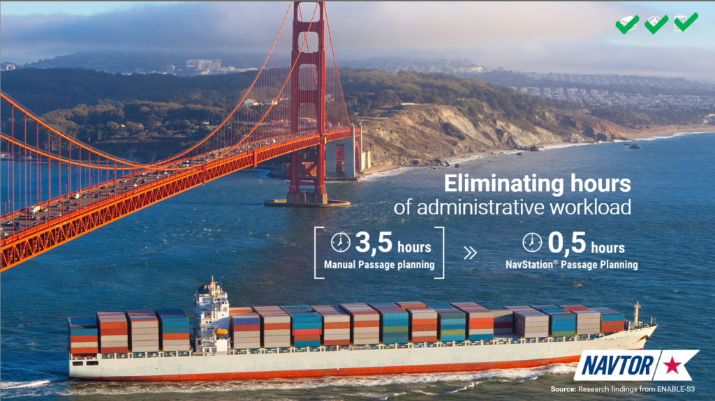
In short, it is no longer necessary to collect information from different sources (paper or digital) to complete a “passage plan”, as all relevant information is integrated directly into the same application.

This is the core of the application! All the information for the aforementioned services are constantly updated automatically and can be displayed as a “layer” directly on the ENC map.

The Passage Plan generated at the end of the planning is also automatically filled in by the software (in SOLAS compliant format). All information entered in the final printout is automatically collected by the services included in the application.

The advantages of NavStation in a few lines

  • Time decrease in drafting the Passage Plan (estimated around 85% less).
  • Reduction of human errors (most of the data are entered automatically and come from official sources only).
  • Integration of all information in a single user interface.
  • Reduction of paper with the effective application of the “paperless” concept.
  • Export of the planned route on the ECDIS.
  • Possibility of sharing passage plans between ships and with the shipping company for checks and approvals.

The companies that have chosen NavStation for the drafting of travel plans have reported the almost total cancellation of remarks by PSCs and Vettings.

Services integrated by the NavStation

ENC maps: the official maps installed on the ECDIS are also provided for the NavStation. In this way, planning is performed on certified data.

Admiralty Digital Publications: the Radio Signals, List of Lights and Tide Tables data are represented as layers on the ENCs, the Sailing Directions displayed in PDF format directly on the software.

Navarea Warnings: all data are shown as “layers” on the ENCs and can be consulted with a click.

Weather Forecast: the application contains meteorological data provided by WeatherNews, displayed directly on the official map. The service also allows you to perform route optimizations, including the ability to set wind or sea limits that are foreseen on the route you are planning, thus allowing you to modify “passage planning” in advance or during construction.

Environmental Manager: this service includes all regulations and notices issued by international, national, regional and ports. The database is updated weekly and all information is shown as a layer on the ENC map allowing for an accurate analysis in compliance with MARPOL regulations and all those issued by other bodies for specific areas or ports.

UKC Calculation: the calculations of the Under Keel Clerance are added, as per regulation, to the bottom of the Passage Plan printout generated by the software and can be performed on any Waypoint / Leg for which the navigation officer deems it necessary. The automatic calculation is based on the official formulas, on the ship data entered by the officer, on the tide data taken from the Tide Tables Admiralty and from the depths recorded on the official ENC charts.

Comments are closed.

Scroll to Top