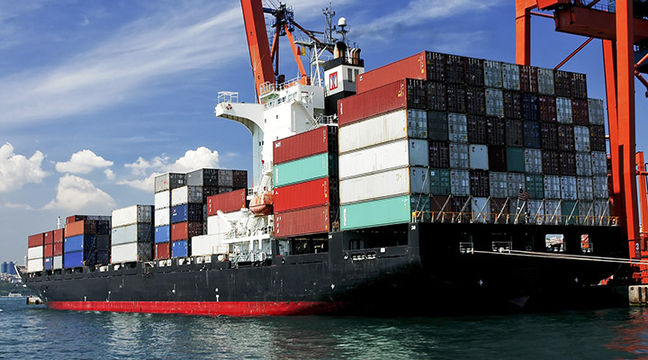
C&C Marine has chosen C-MAP, one of the very first digital cartography brand on the market
E-NAVIGATION DIVISION / BRANDS / C-MAP
C-MAP: Accurate worldwide charts and expertise
Company Information
C-MAP, founded in Italy in 1985, has a proven track record in mapping and services for all types of commercial clients. The ability to integrate and share information across products provides decision support, and standardised data interfaces enable multi-dimensional analysis of performance and efficiency.
C-MAP is one of the first commercial brands to enter the digital cartography market and is compatible with most digital cartography systems.
The vectorisation of paper maps (that later became ENCs) is down to the intuition of an Italian engineer, Fosco Bianchetti – founder of C-MAP. C&C Marine immediately understood its potential and began to distribute the brand on the Italian market.
C-MAP is one of the very first digital cartography brands on the market and is the only brand in the world that includes among its solutions for ECDIS both official ENC cartography and unofficial cartography, the latter named “Professional+”. All the solutions offered by C-MAP (official and unofficial), always include weekly updates that are delivered through its own update software.
C-MAP is the ideal solution to ensure that all management is efficient by reducing training costs, procurement times and IT costs, including ship and office integrations. C-MAP’s MPS group offers a customised approach through its well-coordinated team of experienced marine architects, marine engineers, ship captains and project managers.
SELECTED PRODUCTS
C-MAP product lines for digital navigation
Charts and Publications
C-MAP provides navigational information through a suite of easy-to-use products that save time and maximise choice. C-MAP mapping solutions include CAES (C-MAP ADMIRALTY ENC Service), C-MAP Professional+ global mapping products and AVCS (ADMIRALTY Vector Chart Service).
Route Planning and Fleet Management
C-MAP IMS™ provides solutions for increasing operational efficiency in relation to route planning and nautical information management, reducing cargo damage, and improving safety and forecasting.
The C-MAP IMS™ system optimises and simplifies the passage planning workflow; the web-based C-MAP FleetManager software provides an in-depth and up-to-date real-time view of the fleet’s performance at sea; and the C-MAP ShipReport reporting system manages all electronic logs on board.
Data Management and Licensing
The ENC C-MAP ADMIRALTY service offers the option of choosing the most suitable licensing methods for your company or vessels. Options include FlatFee, FixedFee, OpenENC (PAYS) and DirectLicensing.
Licensing is managed through C-MAP FlatFee (the world’s only fixed fee ENC service) and C-MAP FixedFee (fixed annual fee). Real-time chart updating is done via the Internet, and the C-MAP IMS™ back-of-bridge planning station offers the NauticalManager module for automated chart and publication management.
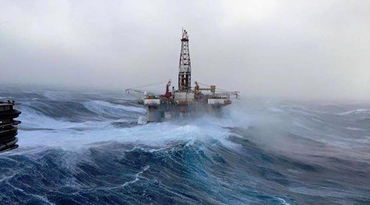
Weather Services
By combining electronic vector charts with the most accurate wind and wave forecasts available in chart display systems, the ability to plan the optimal sea route for a safe voyage is right at your fingertips.
Integration of maps and weather.
Astronomical water levels and currents.
Dedicated forecast for the vessel.
Possibility of distributing or sharing charts and weather information.
Worldwide coverage.
Specific alerts for tropical cyclones.
Software supports http and email updates.
Professional Services
C-MAP professional services include systems integration, staff training and setup of key performance benchmarks; improve fleet efficiency with voyage analysis, simulation studies, and CHG monitoring; and optimally route ships along the coast with input from experienced captains.
Marine Hydrographic Services
C-MAP provides specific services for distributors of S-57 electronic navigational charts and produces traditional paper-based cartography. Services include:
dKart Office, a software system designed for the production and maintenance of nautical charts and navigational publications.
Customised training designed to maximise the efficiency of Hydrographic Offices.